
;Open Apple Maps to view the exact location of the project>>;
Bidding during the period (First Release)
- Jurisdictional Court
- Nagoya District Court Toyohashi Branch
- Case Number
- Reiwa 05 (ケ) No. 27
- Selling base price
- 18,920,000 yen
- Purchase application margin
- 3,784,000 yen
- Available price
- 15,136,000 yen
Object Overview
- location
- 26, 27, 24, 2, 19, 22, 3, 18, Kameyama-cho, Kameyama-cho, Tahara City, Aichi Prefecture
- Traffic on Assessment
-
Toyohashi Railway Atsumi Line "Mikawa Tahara" Station West Road about 22km
About 150m west of the Toyotetsu Bus stop "Kameyama Elementary School" - Total construction area
- 833.40m² (252.1 ping)
- Land area (total)
- 7,311.35m² (2,211.7 pings)
- Apartment Type
- –
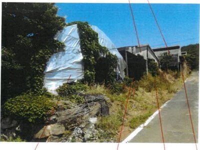
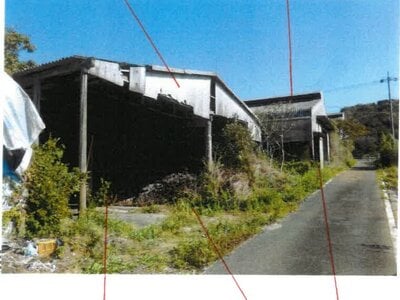
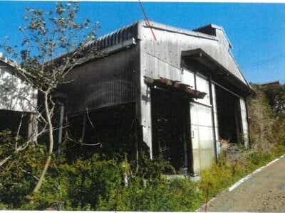
- type
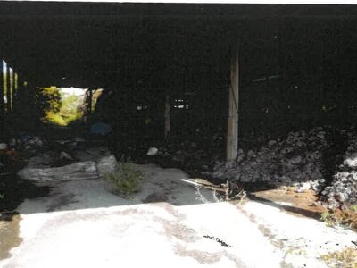
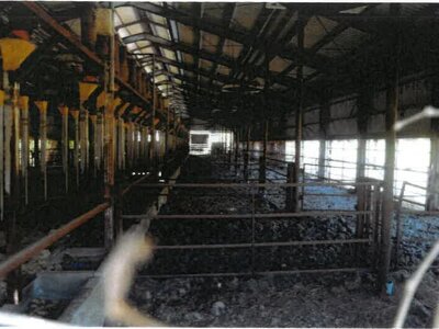
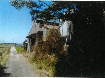
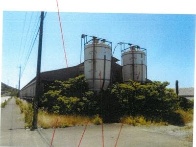
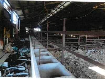
- Cowshed and composting shed
- Area of use
- Urbanization Adjustment Area (redevelopment area that suppresses urbanization and contains many building restrictions)
- Object Number
-
- 1. Building (ownership)
- 4-10. Land
Object Details
- Object Number
- 1
- type
- building
- location
- 26th, 27th, 24th, 2nd, 19th, 22nd, 18th, Kameyama-machi, Kameyama-cho, Tahara City
- House Number
- 26th
- Type(Registration)
- Cowshed and composting shed
- Structure (registration)
- Steel structure slatted roof bungalow
- Building area (registered)
- 833.40m² (252.1 ping)
- Apartment Type
- other
- Land use rights
- ownership
- Possessor
- Debtor and Owner
- Construction year
- September, Showa 58 (1983・41st year of construction)
- Ancillary buildings
-
Symbol 1
Type (Current Status) –
Structure (registration) Steel structure slatted roof bungalow
Structure (Current Status) –
Type (registration) Cowshed
Building area (registered) 726.51m²
Building area (current status) –Symbol 2
Type (Current Status) –
Structure (registration) Steel structure slatted roof bungalow
Structure (Current Status) –
Type (registration) Cowshed
Building area (registered) 723.95m²
Building area (current status) –Symbol 3
Type (Current Status) –
Structure (registration) Timber structure slatted roof bungalow
Structure (Current Status) –
Type (registration) Cowshed and warehouse
Building area (registered) 1305.18m²
Building area (current status) –
- Object Number
- 4
- type
- land
- location
- Kameyama Town, Tahara City, Sugazawa 17 Chapter 1
- Land use (registration)
- Hybrid Land
- Land area (registered)
- 444m² (134.3 ping)
- Area of use
- Urbanization Adjustment Area (redevelopment area that suppresses urbanization and contains many building restrictions)
- Building coverage
- 60%
- Floor Area Ratio
- 200%
- Object Number
- 5
- type
- land
- location
- Chapter 18, Sugazawa, Kameyama Town, Tahara City
- Land use (registration)
- Hybrid Land
- Land use (current status)
- Residential area
- Land area (registered)
- 2,046m² (618.9 ping)
- Area of use
- Urbanization Adjustment Area (redevelopment area that suppresses urbanization and contains many building restrictions)
- Building coverage
- 60%
- Floor Area Ratio
- 200%
- Object Number
- 6
- type
- land
- location
- Chapter 19, Sugazawa, Kameyama Town, Tahara City
- Land use (registration)
- Residential area
- Land area (registered)
- 2,085.95m² (631.0 ping)
- Area of use
- Urbanization Adjustment Area (redevelopment area that suppresses urbanization and contains many building restrictions)
- Building coverage
- 60%
- Floor Area Ratio
- 200%
- Object Number
- 7
- type
- land
- location
- Kameyama Town, Tahara City, Sawazawa 22 Chapter 3
- Land use (registration)
- Residential area
- Land area (registered)
- 156.39m² (47.3 ping)
- Area of use
- Urbanization Adjustment Area (redevelopment area that suppresses urbanization and contains many building restrictions)
- Building coverage
- 60%
- Floor Area Ratio
- 200%
- Object Number
- 8
- type
- land
- location
- Kameyama Town, Tahara City, Sugazawa 24 Chapter 2
- Land use (registration)
- Residential area
- Land area (registered)
- 817.59m² (247.3 ping)
- Area of use
- Urbanization Adjustment Area (redevelopment area that suppresses urbanization and contains many building restrictions)
- Building coverage
- 60%
- Floor Area Ratio
- 200%
- Object Number
- 9
- type
- land
- location
- Chapter 26, Sugazawa, Kameyama Town, Tahara City
- Land use (registration)
- Residential area
- Land area (registered)
- 1,173m² (354.8 ping)
- Area of use
- Urbanization Adjustment Area (redevelopment area that suppresses urbanization and contains many building restrictions)
- Building coverage
- 60%
- Floor Area Ratio
- 200%
- Object Number
- 10
- type
- land
- location
- No. 27, Sugazawa, Kameyama Town, Tahara City
- Land use (registration)
- Residential area
- Land area (registered)
- 588.42m² (178.0 ping)
- Area of use
- Urbanization Adjustment Area (redevelopment area that suppresses urbanization and contains many building restrictions)
- Building coverage
- 60%
- Floor Area Ratio
- 200%
- Precautions
- Please be sure to download the three-piece set of property documents (property details, current situation investigation report, and evaluation report, etc.) to confirm the content of this detailed information page (there may be a report under Article 63, Item 2, Item 1 of the Civil Execution Act). The photos, materials, and drawings cited in the "current situation investigation report" and "evaluation report" downloaded from this system may not be attached to this system.
Sales Schedule
- Sale implementation date
- 2024